
Solution-oriented GIS Analyst and Software Developer with extensive expertise in spatial analysis, geospatial technologies, and automation using Python APIs, JavaScript, and scripting languages. Proficient in geospatial software such as ArcGIS Pro, QGIS, and database systems like MySQL, PostgreSQL, and MongoDB. Skilled in conducting advanced geoprocessing tasks such as spatial interpolation, network analysis, raster analysis, and flood analyses. Experienced in creating customized geospatial workflows, automating repetitive GIS tasks. Known for my attention to detail and problem-solving skills, I have successfully executed GIS and software projects from conceptualization to completion.
Sep 2023 - Present
- Managed first-level technical support for end-users, resolving hardware and software issues to enhance productivity and minimize downtime.
- Designed and implemented GIS databases with PostgreSQL and SQL, enhancing spatial data accessibility and reducing query times by 30%.
- Diagnosed and troubleshot complex IT problems, providing timely assistance and guidance to users using Python, JavaScript and SQL.
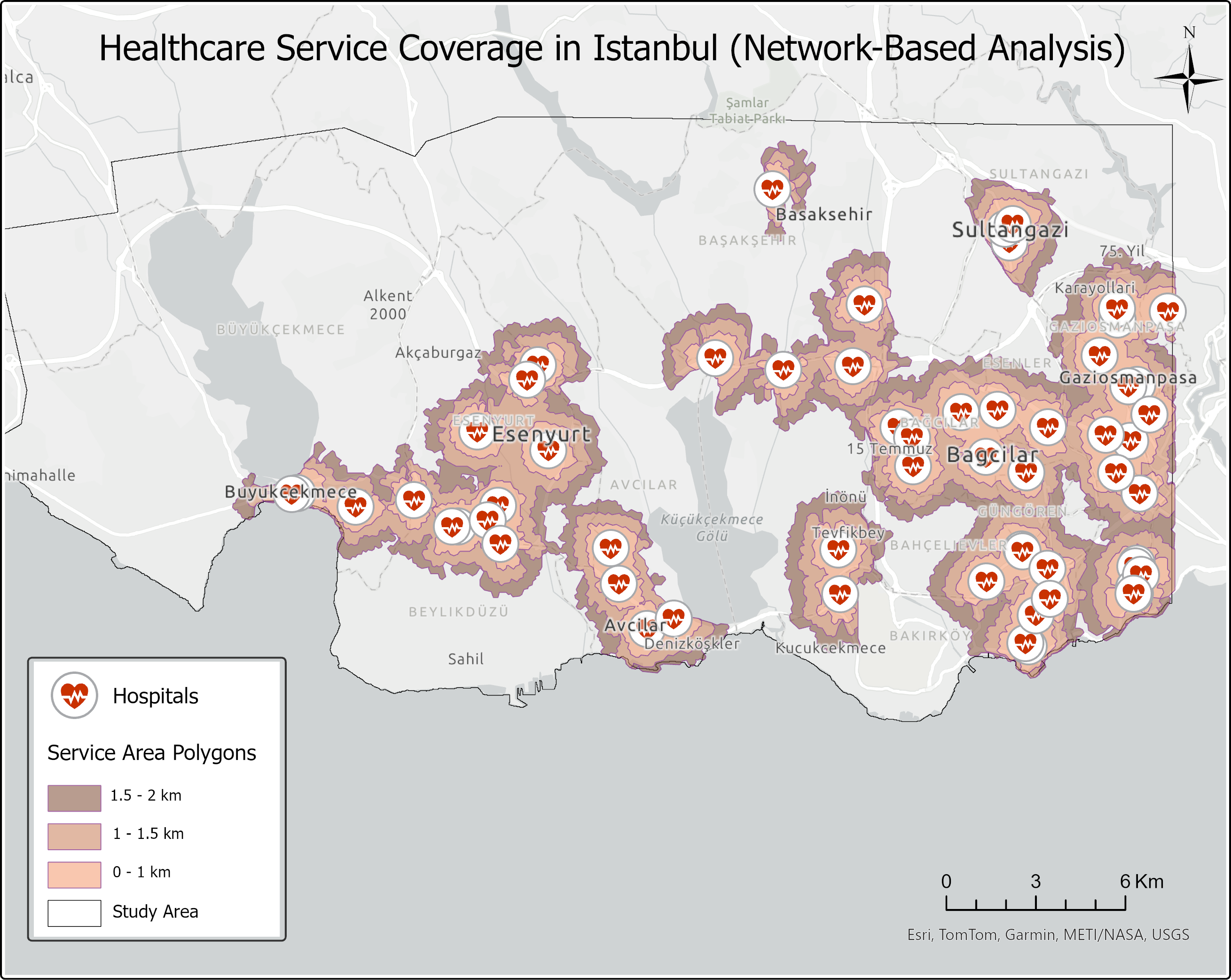
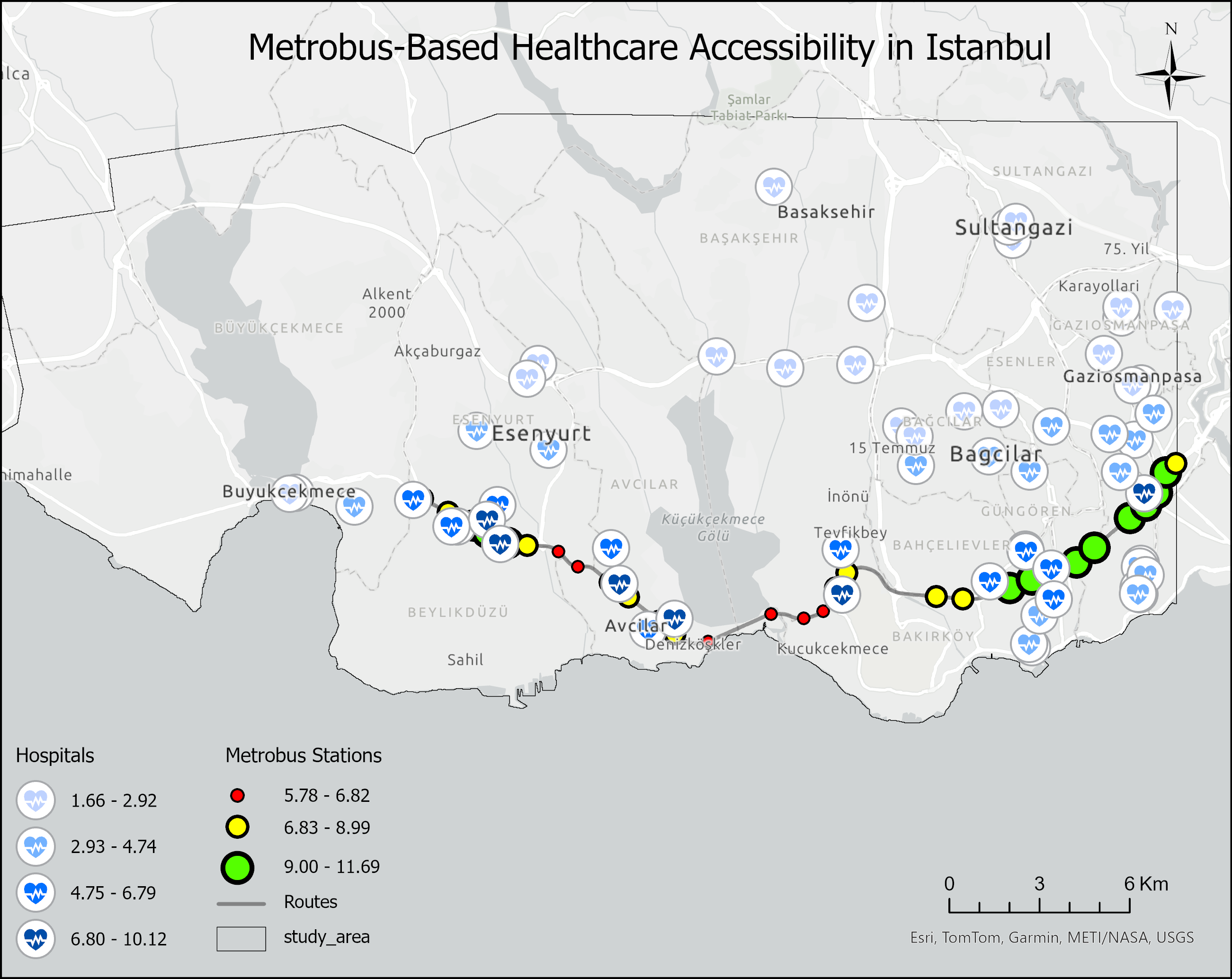
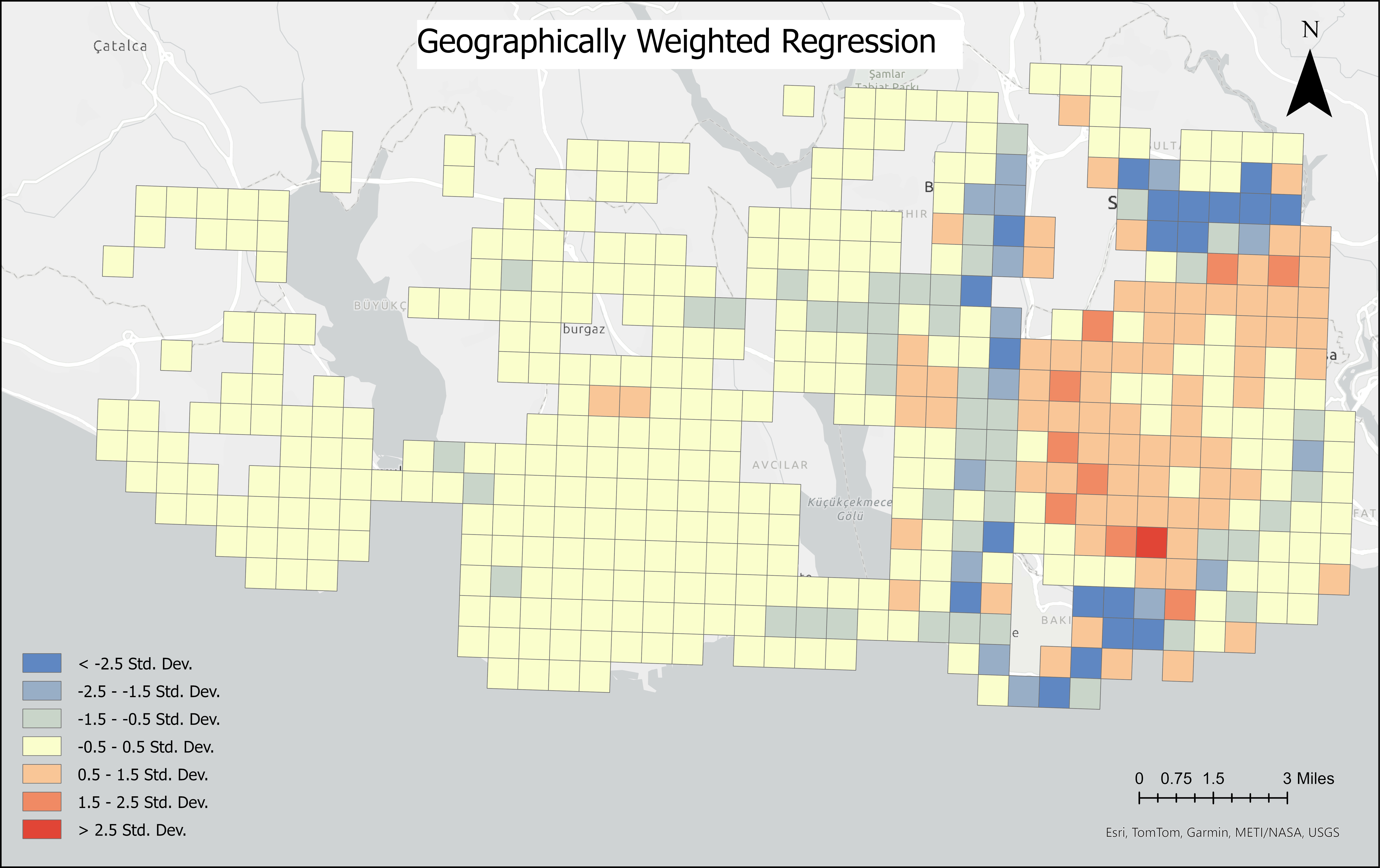
- Conducted spatial analysis and developed mapping solutions using ArcGIS and Esri Tools to support organizational goals.
- Streamlined troubleshooting and support processes for end-users, reducing resolution times for hardware and software issues by 35%.
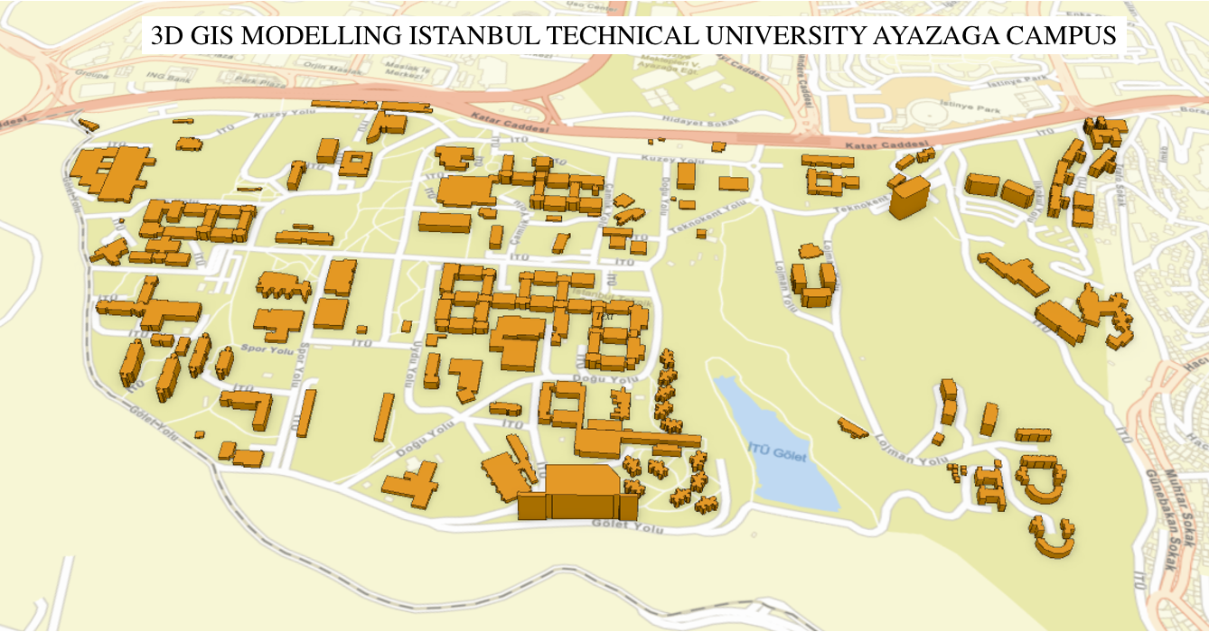
Sep 2022 - Jun 2023
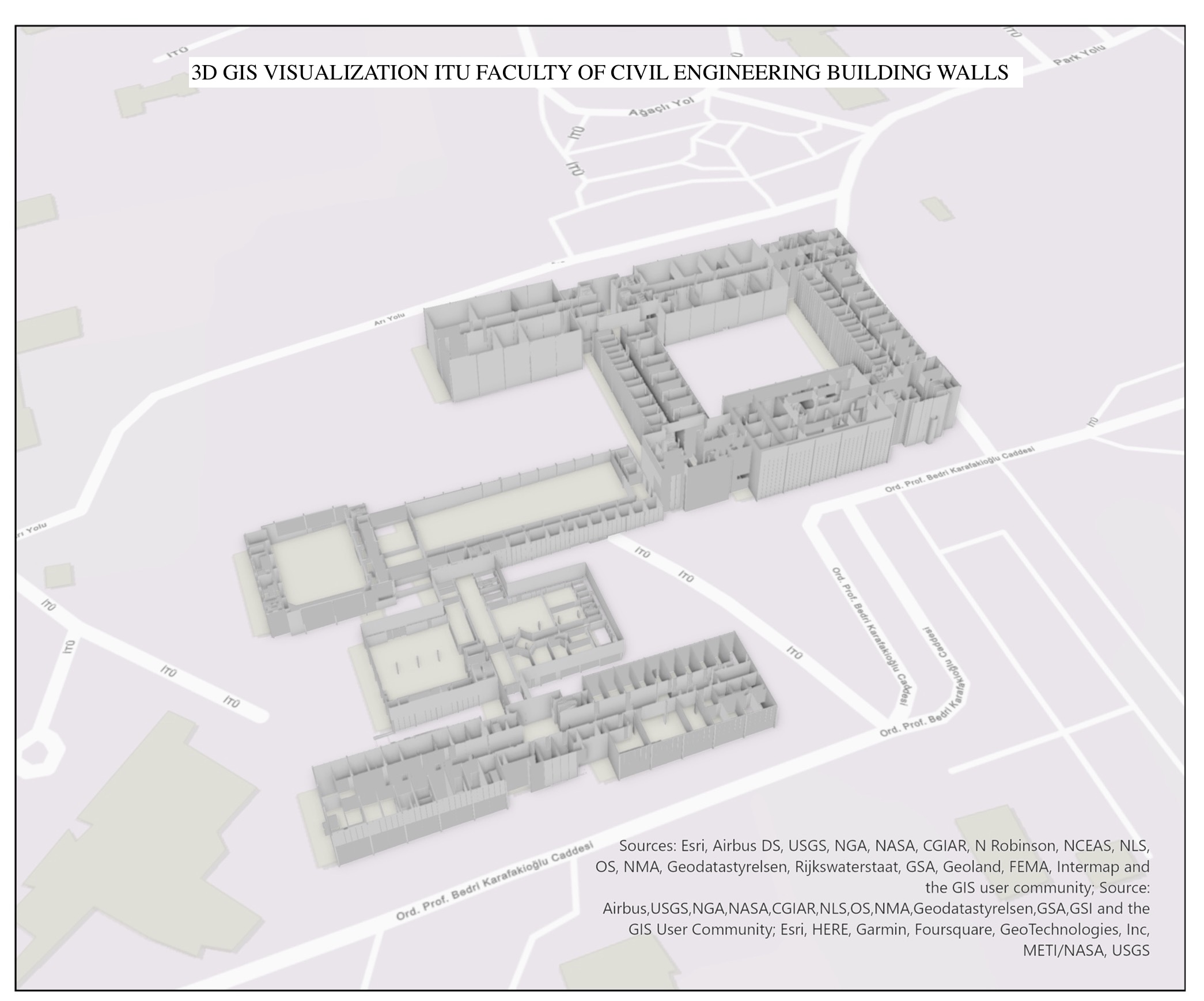
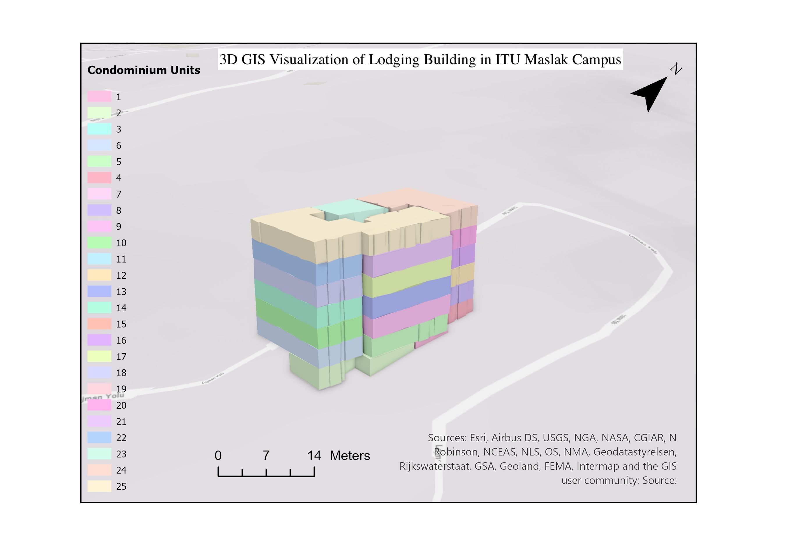
- Three-Dimensional Campus modelling was created in order to improve campus building planning, navigation, and management, three-dimensional campus modeling was developed.
- The method used in this study is to extract 3D data from current architectural projects, following to specific requirements.
- Throughout the investigation, ArcGIS and QGIS applications were utilized.
- The CityGML format was obtained using FME Workbench and FME Data Inspector tools.
- Using the FME program, research on 3D modeling was conducted by converting shape-based file formats to CityGML format.
- Analyzed results using software programs and produce reports. Collected and examined data in order to provide outcome reports. With 3D GIS modelling aimed to decreases expenses up to %45.
Jan 2023 - Mar 2023
- Delivered highly detailed indoor maps for navigation projects using QGIS and PostGIS, increasing spatial data accuracy by 25% and improving client satisfaction.
- Enhanced spatial database quality through optimized management in PostgreSQL and data analysis in Excel, reducing data processing time by 20%.
- Analyzed geospatial data obtained from airports to extract valuable insights and patterns.
- Processed and managed large datasets in PostgreSQL, working with dump data for analysis.
- Spatial analyses were performed using Python and GIS libraries such as GDAL and SAGA.
- The queries made while creating the analyses were also performed in SQL language and shared with colleagues.
- Thematic maps were created with QGIS and presented manager in the desired purposes.
Sep 2020 - Jan 2021
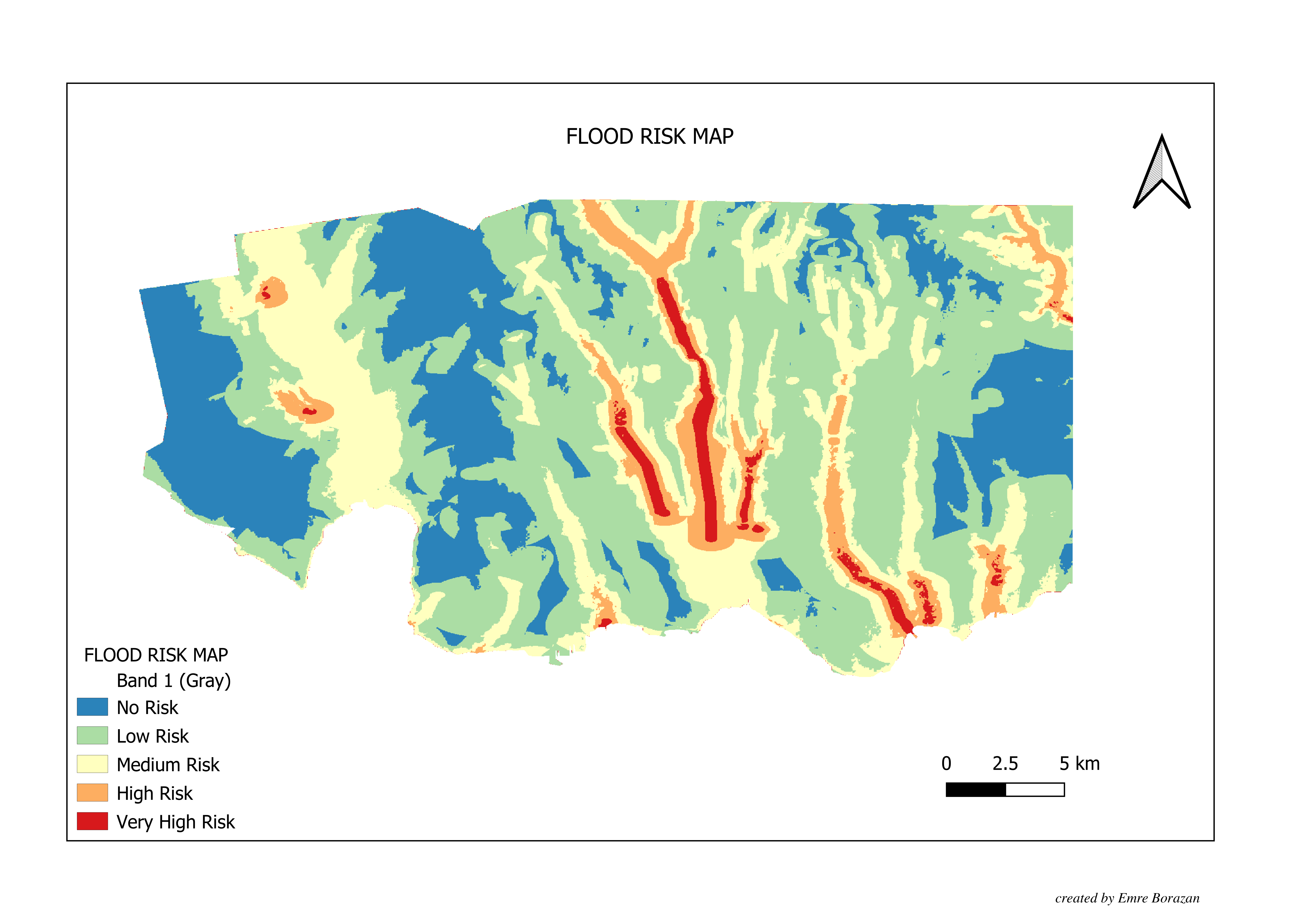
- Conducted precise land surveys for factories and gas pipelines using GPS and GIS technologies, improving data accuracy and ensuring compliance with regulatory standards.
- Collaborating on allotment-amalgamation processes, ensuring efficient land use and management with retrived goverment data.
- Optimized land use and management processes by leveraging GIS and GPS technologies, reducing spatial data processing time by 25%.
- Provided detailed spatial data for pipelines and utility systems, increasing infrastructure planning and maintenance efficiency by 20%.
Istanbul Technical University
Address
Denver, COLORADO
emre@emreborazan.com